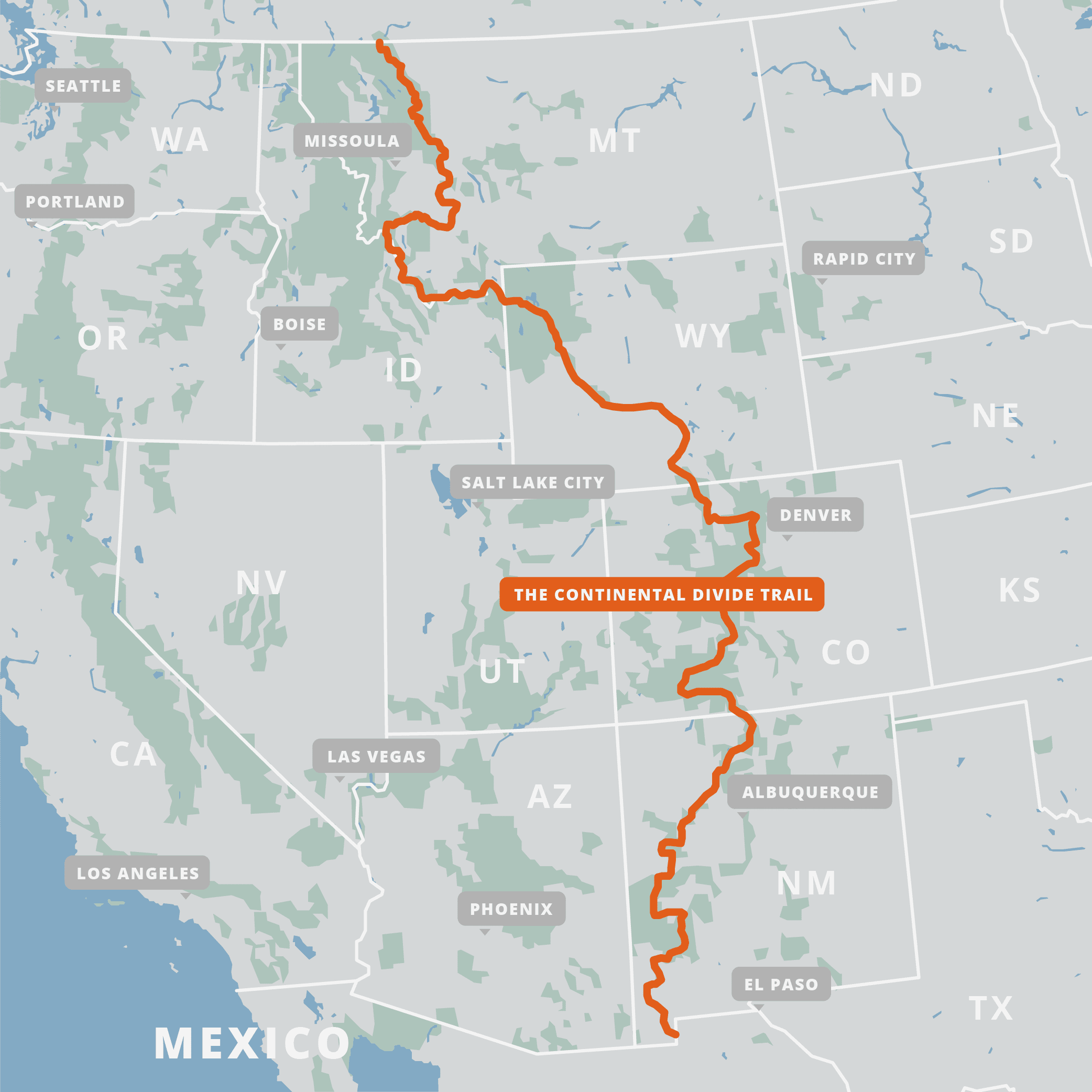
Congress established the Continental Divide Trail, also known as the CDT, in 1978. One of the largest conservation efforts in the history of the United States. The Continental Divide National Scenic Trail (CDT) is much more than just a line on a map: it is a living museum of the American West. The trail stretches 3,100 miles across the US from Mexico to Canada. This trail spans roughly 5 states including: New Mexico, Colorado, Wyoming, northern Idaho and Montana. From the deserts of New Mexico to the alpine peaks of the northern Rockies, the Continental Divide Trail winds its way through the stunning and diverse landscapes of the central United States.
What is the Continental Divide?
The headwaters of our nation, spring from the Continental Divide. Imagine a line running the entire length of North and South America. This line runs north to south along the very highest elevations of these continents. It connects the peaks of the Rocky Mountains with the Andes in South America. Rain or snow that falls on these peaks will flow either to the east or to the west, eventually ending up in the Pacific or Atlantic Ocean. The map below shows how water flows from the Continental Divide into streams and rivers, eventually making their way to the oceans. Many of the US’s largest rivers begin as a trickle of water near the Continental Divide.
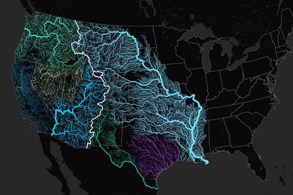
Cross Section of the Country
Indigenous peoples of North America were the first people to live along the waterways of this divide. The CDT follows the footsteps of Geronimo, tribal people and ancient traders. This route is sparsely populated with more wildlife than people to encounter. In addition, it is one of the most significant trail systems in the world. It’s the highest, most remote, and, in many ways, most challenging of our National Scenic Trails. Furthermore, this trail provides a window into the rich history of the West, from the history of indigenous peoples to westward expansion. The southern starting point of the CDT can be found at the Crazy Cook Monument near Hachita, New Mexico. The northern endpoint of the trail: Waterton Lake on the Canadian border.

Best Time to Hike
Depending on which direction you are travelling will determine when to start. Traveling northbound? You would want to begin early April to beat the summer heat of the southern states. Travelers coming from the north, typically head out mid June after the snowpack melts in Glacier National Park. Be sure to pack accordingly! This trail crosses through several diverse ecosystems, ranging from desert to snow-packed mountains, all at elevations above 4,200 feet! For instance, the arid desert land of Northern New Mexico quickly turns to lush, rocky mountains in Colorado. More so, the further north you travel, snowy mountain passes of Montana will be a stark contrast to where you started your travels. As this hike gains popularity, more resources become available. Be sure to do your research and plan accordingly!

The Future of the CDT
96 percent of the Trail is located on federal land managed by the US Forest Service, Bureau of Land Management, or the National Park Service. Along with several other conservation non-profit organizations, these organizations work tirelessly to maintain the lands this trail passes through. In conclusion, The Continental Divide Trail has been specially designated as a National Scenic Trail by Congress to ensure that the scenic beauty will be conserved for generations to come. It’s more important now than ever to help minimize your impact on the environment. Make sure you know and practice the Leave No Trace Principles during your hike.